
Last Updated: November 1, 2026
Quick Summary
Plan infrared drone services for remote sites by scoping the asset and question, checking airspace and Transport Canada RPAS permissions, setting the environmental window, building the flight plan, and planning power and crew. Capture radiometric data to onboard storage, then verify frames on site before leaving.
- Thermal contrast is strongest when the sun is low or the site is under steady load.
- Ask whether data is radiometric, since qualitative findings are hard to trend over time.
- Remote sites need spare batteries, a charging plan, and a launch point clear of hazards.
- Capture to onboard storage first and treat live downlink as a convenience, not a dependency.
- A thermal report should include GPS-tagged locations and a severity rating per finding.
Table of Contents
- Why Infrared Drone Services for Remote Sites Beat Crewed Inspections
- Choosing Thermal Drone Inspection Services: What to Verify
- How Drone Thermal Imaging Works on a Remote Mission
- Drone Inspection Safety Planning for Remote and Confined Sites
- What a Thermal Inspection Report Should Include
- Get a Quote for Your Remote Site Inspection
- Frequently Asked Questions
Why Infrared Drone Services for Remote Sites Beat Crewed Inspections
Infrared drone services for remote sites put a certified thermal camera in the air in minutes, without scaffolding, rope access, or a crew standing on a roof in the wind. At MTN Thermal Drone Services, we fly these missions because the alternative, sending people onto remote structures, is slower and riskier. A drone flight captures a full thermal record of a site in a single visit.
What Thermal Imaging Finds That a Visual Walkthrough Misses
Thermography is the practice of reading surface temperature to find problems invisible to the eye. A visual walkthrough sees stains and cracks. A thermal camera sees the heat behind them.
- Electrical hotspots before a breaker fails
- Heat loss through failed insulation
- Moisture trapped inside a roof assembly
Access, Cost, and Safety Trade-offs
The trade-off is simple. Crewed inspections need lifts, harnesses, and safe weather windows. Drones need a launch point and a clear flight plan.
- No work at height for your staff
- Large-area coverage in one flight
- Night operation without extra lighting
Watch out: thermal readings drift when the sun hits a surface directly. Timing the flight matters as much as the camera.
Choosing Thermal Drone Inspection Services: What to Verify
Thermal drone inspection services are only as good as the operator behind the camera. Ask for proof before you book, and ask questions that separate a provider who flies a thermal camera from one who can defend the numbers in the report.
Certifications and Transport Canada RPAS Requirements
In Canada, commercial drone work falls under the RPAS rules set by Transport Canada, including pilot certification and registration (Flying your drone safely and legally). Ask any provider for their pilot certificates and aircraft registration, and confirm the pilot holds the certification level the site requires. Our team holds advanced RPAS certification from Transport Canada and ITC certified thermographer credentials, and you can read more on our drone laws page.
Sensor Choice and What It Means for Your Data
The sensor decides what you can measure. A low-resolution thermal camera shows blobs. A radiometric sensor gives you temperature values per pixel, which is what lets a report state a temperature rather than a color. We fly a DJI Matrice 30T with FLIR infrared technology and RTK positioning, which keeps readings tied to real coordinates.
When you compare providers, ask:
- Is the data radiometric? If not, findings are qualitative and hard to trend over time.
- What is the thermal resolution? More pixels on a small target means a small connection is less likely to be missed.
- Is there a visual camera for overlay? A thermal image alone is hard to locate on a large asset.
If you want to check credentials and background before choosing a provider, see about our drone services.
How Drone Thermal Imaging Works on a Remote Mission
Drone thermal imaging works by capturing surface temperature across a whole site, then turning that data into a report you can act on. The flight is the short part. The planning and processing carry the value.
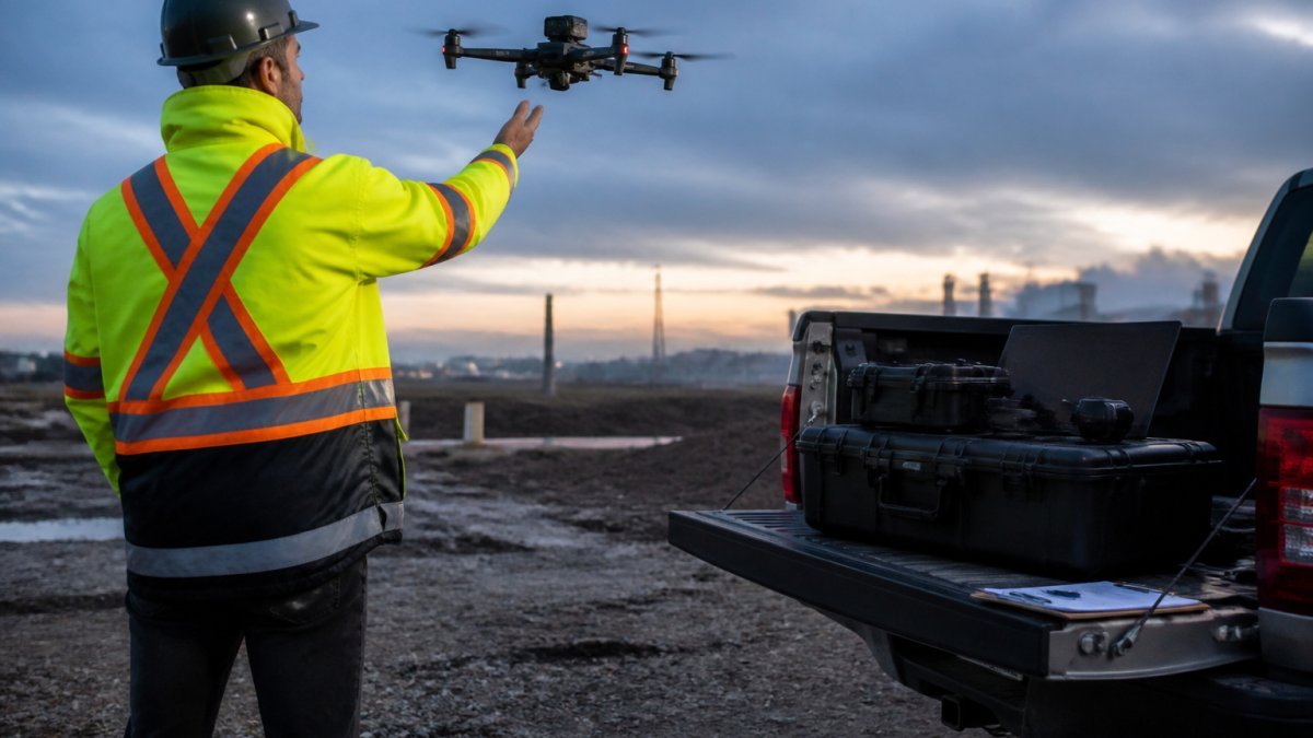
Step-by-Step Planning for a Remote Thermal Mission
A sound remote mission follows a sequence like this, and skipping a step can turn a flight into a wasted trip:
- Scope the asset and the question. Decide whether the goal is electrical hotspots, building envelope heat loss, solar string faults, or ground-surface anomalies. The answer changes the sensor, the altitude, and the time of day.
- Check airspace and permissions. Confirm the site is outside controlled airspace or that the required authorization is in place, and check for any site-specific flight restrictions. Advanced RPAS certification and aircraft registration are the baseline under Transport Canada rules.
- Set the environmental window. Thermal contrast is strongest when the sun is low or the site is under steady load. For electrical work, the asset should be energized and carrying a representative load; for envelope work, a period of heating or cooling before the flight improves contrast.
- Build the flight plan. Set altitude, overlap, and camera angle so passes are even and images stitch cleanly.
- Plan power and crew. Operating range and flight time set how much ground one aircraft covers before a battery swap. Remote sites need spare batteries, a charging plan, and a launch point that stays clear of hazards.
- Capture, then verify on site. Review a sample of radiometric frames before leaving to confirm focus, exposure, and that the anomalies you expected are visible.
Sensor Selection and Image Interpretation
The sensor decides what you can measure. A low-resolution thermal camera shows blobs; a radiometric sensor gives you a temperature value per pixel, which is what makes a finding defensible.
Interpretation is where experience shows. Emissivity varies by surface, so a shiny metal fitting can read cooler or hotter than it really is. Reflected heat from the sun, warm exhaust, or nearby equipment can mimic a fault.
Connectivity, Data Transfer, and Offline Workflows
Remote sites often have no reliable signal. The workflow has to assume that:
- Capture to onboard storage first, and treat any live downlink as a convenience, not a dependency.
- Carry enough storage for the full mission plus a margin, and back up to a rugged drive before leaving the site.
- Process radiometric data back at base, where the software and power are reliable.
A weak connection should never cost you a flight. For more on how we run these missions, see our thermal drone blog.
Drone Inspection Safety Planning for Remote and Confined Sites
Drone inspection safety planning covers airspace, weather, site hazards, and crew roles before anyone drives out. On a remote site, the nearest help is far away, so the plan carries more weight.
Site Access, Weather, and Night Operations
Wind, rain, and cold all affect flight. A good operator sets limits and sticks to them. Our services are designed to operate day or night, which matters for emergency response and for sites that only shut down after dark.
Watch out: confined-space and shaft inspections need a launch plan that keeps the aircraft clear of walls and keeps people out of the hazard zone.
What a Thermal Inspection Report Should Include
A thermal inspection report should tell you what was found, where it is, and how urgent it is. Anything less is just pictures.
Accuracy, Deliverables, and Measurable Outcomes
Look for these in any report:
- Radiometric images with temperature values
- GPS-tagged locations for every anomaly
- A severity rating per finding
RTK positioning and photogrammetry support precise measurements, so findings can be tied to your site drawings. If you want to see sample imagery before booking, browse our gallery.
| Finding | What It Looks Like | Typical Next Step |
|---|---|---|
| Electrical hotspot | Bright spot on a connection | Thermal scan and tighten |
| Heat loss | Warm patch on a wall or roof | Check insulation |
| Moisture | Cool, uneven patch | Open and dry the area |
| Solar fault | One hot or cold cell | Test the panel string |
Get a Quote for Your Remote Site Inspection
Remote sites reward preparation. A clear flight plan, the right sensor, and a report you can act on make a single flight more useful. We fly day or night, in complex terrain, with certified thermographers on every job.
Ready to book? Contact us for a quote and tell us about your site.
Frequently Asked Questions
What can an infrared drone inspection detect at an industrial site?
Thermal imaging picks up temperature differences that the eye cannot see. On industrial sites it typically reveals loose or overloaded electrical connections, failing motors and bearings, insulation gaps, moisture intrusion, and solar panel hotspots. At remote sites this matters because the drone reaches assets you would otherwise need crews, lifts, or shutdowns to inspect. A certified thermographer interprets the imagery.
What certifications should an infrared drone service provider have?
Ask for two things: Transport Canada RPAS certification for the pilot and Advanced operations, and thermography training such as ITC certification for whoever interprets the images. A pilot licence alone does not make someone a thermographer. Also ask whether they carry liability insurance and can share sample reports. Verifying credentials before booking saves you from paying for pretty pictures with no diagnostic value.
How should a site prepare for a thermal drone inspection?
Give the provider site access details, a contact on the ground, and a clear list of assets to inspect. Thermal contrast matters, so equipment should be under normal load where possible, and you should flag any areas with restricted airspace or active work. Share weather expectations and confirm whether night flights are needed. Good drone inspection safety planning starts with your site rules, so send them the site orientation and any lockout or exclusion zones in advance.
How much does an infrared drone inspection cost for a remote site?
Pricing depends on travel distance, site size, number of assets, flight time, and the depth of the thermal inspection report you need. Remote sites can carry extra logistics, so ask how travel and any overnight stays are handled in a quote. MTN Thermal Drone Services can provide a quote based on your site details, so share the scope with them to confirm what fits your budget.
Send us your site details and we will scope the mission. MTN Thermal Drone Services brings advanced Transport Canada RPAS certification, ITC-certified thermographers, and DJI Matrice 30T drones with FLIR infrared technology and RTK positioning to every job. Get started with MTN Thermal Drone Services and turn your next inspection into data you can act on.
